Daddy's Christmas Angel

Wednesday, April 30, 2014

"Z" is for Zion National Park

Zion National Park, established in 1919, was the first of Utah's five National Parks. According to the National Park Service site, the people there 12,000 years ago hunted mammoths, giant sloths, and camels. Then by about 8,000 years ago, over-hunting and climate change caused those animals to die out. The people then focused on hunting smaller animals and gathering food. The Zion elevations, 3,666 to 8,726 feet, proved ideal for growing certain crops. Mormon pioneer settlers arrived there in 1856 and endured the hardship of flash floods and drought.

ZION 14581
Howard Russell Butler
"Zion Canyon", 1903, by Frederick S. Dellenbaugh, 1903 Oil on canvas, Zion Museum Collection ZION 38105
Frederick Samuel Dellenbaugh
The dramatic scenery of the 15-mile long Zion Canyon cut along the north folk of the Virgin River has inspired numerous artists, including Howard Russell Butler and Frederick Samuel Dellenbaugh. How fortunate that artists visited this National Park and inspired us with their depictions of the unforgettable scenery. The museum at Zion National Park houses some of this work.

"Mountains of the Sun" by Howard Russell Butler, 1926
Zion Museum Collection ZION 14586  

Howard Russell Butler

Tuesday, April 29, 2014

"Y" is for Yellowstone and Yosemite National Parks

"In Yellowstone" ©Mary Montague Sikes
Yellowstone National Park. Yosemite National Park. For me, both of these expansive and beautiful parks are intriguing.

We've visited Yellowstone which was established in 1872 as America's first National Park. Home of the most geysers in all the world, the park is worth a trip there just to view these scenic natural phenomena.

When we flew into Sacramento CA a couple of years ago, we had planned to drive down and take Highway 120 through the park. Although it was early June, the road was closed due to snow. The park alert shows the road is closed now, but expected to open sometime in May. We were disappointed and hope to return to the area and actually visit Yosemite.

Vernal Fall and rainbow
"Vernal Fall" National Park Service Photo
Known for its waterfalls, Yosemite was first protected as long ago as 1864. The park encompasses 1200 square miles and in photographs appears much more rugged than Yellowstone.

Yosemite National Park is definitely on my list of places to visit. Yellowstone is on the list of National Parks to revisit.

Monday, April 28, 2014

"X" is for the X-Factor in National Parks

"Yellowstone - Where the Buffalo Roam" ©Mary Montague Sikes
Since there are no "X" National Parks, I started to wonder what the "X-Factor" might be in the creation of those parks. Our nation was very fortunate that President Thomas Jefferson sent out the Lewis and Clark Expedition to explore the western territories in 1804.

Then I think of John Muir, the naturalist who walked from Indiana to Florida and eventually explored California by foot. Co-founder of the Sierra Club, Muir was instrumental in establishment of the Sequoia, Grand Canyon, and Yosemite National Parks. In 1903, he went on a three-night camping trip with President Theodore Roosevelt and is said to have influenced his conservation interests. Roosevelt, of course, was a huge champion of the National Parks.

I think also of the great photographer, Ansel Adams, whose iconic photographs of scenes from Yosemite and Yellowstone National Parks depict nature in a unique and unforgettable fashion. Interesting that he was injured during the San Francisco earthquake of 1906. When he was thrown against a garden wall during an aftershock, his nose was broken and never properly repaired. He spent time in New Mexico with one of my favorite artists, Georgia O'Keeffe. He, too, was a great conservationist as well as an explorer of nature and the environment.

The X-Factor for the National Parks is the glory of exploration. Americans love to explore. Thankfully, we also have conserved these beautiful lands that became our National Parks.


Sunday, April 27, 2014

"W" is for Wind Cave National Park

Skyway Lake, stalactites, Wind Cave 
"Skyway Lake with Stalactites in Wind Cave" National Park Service Photo
Wind Cave National Park in western South Dakota is yet another National Park established by President Theodore Roosevelt. The park, designated in 1903, is the eighth in the system and the first cave park in the world. Located 10 miles north of Hot Springs, it has 140.47 miles of explored passageways with more discovered each year. The photographs on the National Park Service site are spectacular. It must be a cave explorer's dream place.

The cave was considered sacred by the Lakota who lived in the Black Hills. They believed it was the place where they had first emerged from the underworld. In 1881, Jesse and Tom Bingham were attracted to the cave by the whistling wind sound. Reportedly, the wind was so forceful, it blew off Tom's hat; then days later, when Jesse returned, his hat was sucked into the cave. According to the National Park site, "the movement of the wind is related to the difference in atmospheric pressure between the cave and the surface."

Today, above the cave, bison, prairie dogs, and elk roam among the prairie grasses. While the cave system sounds intriguing, I am too claustrophobic to add Wind Cave National Park to my bucket list. However, Theodore Roosevelt is fast becoming my favorite American President. 

Friday, April 25, 2014

"V" is for Virgin Islands National Park

French Grunts
French Grunts - National Park Service Photo

The island of St. John is the location of the 7000-acre Virgin Islands National Park. In addition, the park includes about 95% of Hassel Island  which is the western edge of St. Thomas Harbor. Hassel Island is about 135 acres in size and is 267 feet high.
Years ago, when we visited St. Thomas, we took a catamaran day-long trip to St. John and anchored offshore. The island is a lush-foliage paradise that features glorious beaches, hills, and valleys. Snorkeling and scuba diving are among the park's offerings, along with both short and long hiking trail excursions.
It is interesting to know that important prehistoric sites are located on almost every beach and bay in the National Park. I was unaware that many of these archeological sites date back to 840 BC. I also did not know about the Caribbean rock art found on the island.

There is a park alert currently for "two mosquito transmitted diseases (virus), Dengue, and Chikungunya Fever, now in the Caribbean. Both viruses are transmitted by Aedes species mosquitoes, which have black and white stripes markings." That news is disturbing.

I love the Caribbean islands and am glad the National Parks include the island of St. John. If we visit St. Thomas again, I'll be sure to go explore Hassel Island. I'll also visit the Virgin Islands Archeology Blog which tells about the experiences of some of the Virgin Islands National Park interns.


Hawksnest Bay ©
National Park Service Photo


Thursday, April 24, 2014

"U" is for Utah National Parks

"Delicate Arch" National Parks photo
Did you know that Utah is a treasure trove of National Parks? The state is home to five of them: Arches, Bryce Canyon, Capitol Reef, Canyonlands, and Zion.

Located in southeastern Utah, Arches must be a photographer's dream. A three-mile round trip hike is recommended to visit the famed "Delicate Arch". The Fiery Furnace hike requires a guide because of dead end paths and narrow passages. There's also Park Avenue, the one-mile walk through giant sandstone towers.

Capitol Reef National Park features a 100-mile long buckle in the earth's surface that goes from Thousand Lake Mountain down to Lake Powell. Erosion along the fold has created deep canyons and other interesting rock formations. When we were in Page, Arizona, I didn't realize as I took pictures of Lake Powell that I was also photographing part of the Capitol Reef National Park.
"Lake Powell" ©Mary Montague Sikes

Canyonlands National Park is east of Capitol Reef and west and south of Moab, Utah. It is said to feature some of the most challenging white water rapids in the world.

Zion National Park will be the subject of another post, and Bryce Canyon was the subject of my "B" National Parks.

What a fascinating trip it would be to visit all five of the National Parks of Utah at one time. It's on my bucket list.


Wednesday, April 23, 2014

"T" is for Theodore Roosevelt National Park

Prehistoric Swamp Mural
"Prehistoric Swamp Mural" on display, South Unit Visitor Center - National Parks Service photo
Theodore Roosevelt. As I write about the National Parks, the name of Theodore Roosevelt appears again and again. Roosevelt first came to the Badlands of North Dakota in 1883. He came to hunt bison but fell in love with the land and the rugged lifestyle of the West. This led to his investment in the Maltese Cross Ranch and later, the Elkhorn Ranch, 35 miles north of Medora.

Caprocks
"Badlands" National Park Service photo
The Theodore Roosevelt National Park is composed of three sections: the North Unit, the South Unit, and the Elkhorn Ranch Unit. The Little Missouri River flows through the park which contains 110 square miles.

Roosevelt wrote articles and major works about his adventures and ranch life in the West. He served as President of the United States in 1901-09 when he did much to promote conservation policies.

The Theodore Roosevelt National Park is high on my list of parks I would love to visit.

Tuesday, April 22, 2014

"S" is for Sequoia & Kings Canyon National Parks

I haven't seen the giant sequoias in Sequoia and Kings Canyon National Parks since the time we visited the Muir Woods. Last year, when we traveled to Glacier National Park, I was reminded of the sequoias while walking on the Trail of the Cedars there.  The giant red and black cedar trees in Glacier are old but not nearly so old as the giant sequoias. We are fortunate that the foresight of others saved the cedars as well as the giant sequoias from destruction.

When Congress established Sequoia and General Grant National Parks in 1890, they became the second and fourth in the National Parks System. Today, Sequoia and Kings Canyon National Parks are adjacent to each other in the southern Sierra Nevada Mountains which rise as high as 14,494 feet within the parks. Besides the world's largest trees, the diverse terrain of the parks includes mountains, canyons, and vast caverns.

To learn more about the wonderful history of these parks, read the book, Challenge of the Big Trees on the park website.


"Giant Cedar" ©Mary Montague Sikes
"Trail of the Cedars" ©Mary Montague Sikes
cluster of sequoias

"Giant Sequoias" National Parks Photo

Monday, April 21, 2014

"R" is for Rocky Mountain National Park

"Colorado Rockies" ©Mary Montague Sikes
Several years ago, when we visited 
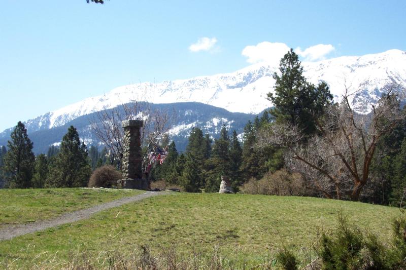
Rocky Mountain National Park, I was caught by surprise as I walked along a trail in the snow. It was late June, and I had not expected snow. Obviously, I was younger and more naive. Now, snow, no matter what season, in the Rockies fails to surprise me.

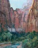
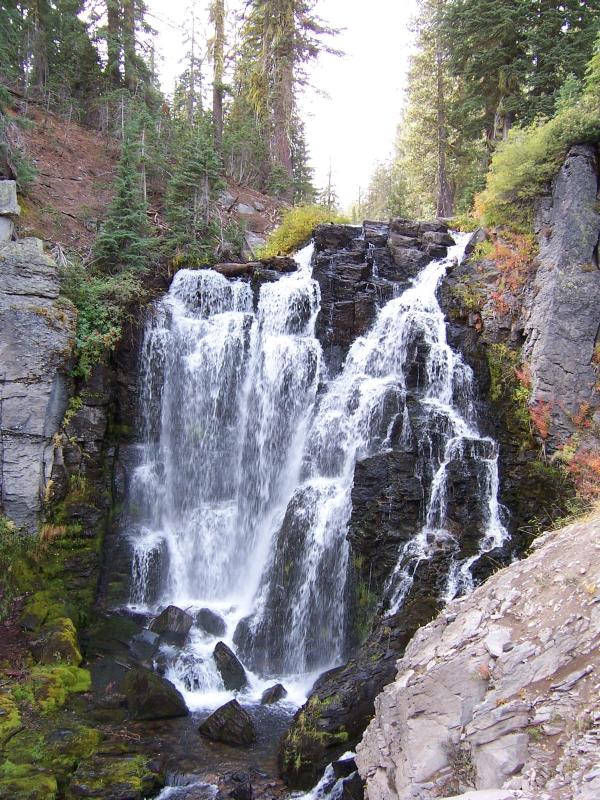
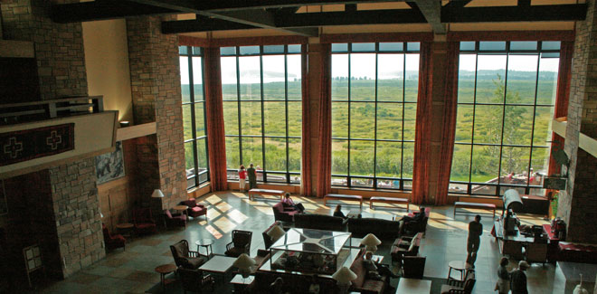
The trees along the trail we followed in the park were green and picturesque. I don't recall the name of the trail, but it parallels the North Fork Colorado River and provides views of unforgettable mountain scenery. The rugged mountain terrain provided me with many photographs and side stories for my book, Hotels to Remember. We entered the park, which is north of Silver Creek and Highway 34, at the Lake Grand entrance. Visitors to the park this year will find the scenic Trail Ridge Road closed due to floods in 2013. That breathtaking road ascends to 12,183 feet.

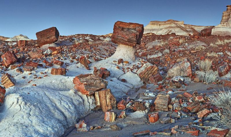
Rocky Mountain National Park was established in 1915. More than 300 prehistoric sites have been found there at high elevations, from 8,000 to 13,000 feet. Interesting that this is another area that has been home to a human population for about 10,000 years.
"Colorado Rockies in the Summer" ©Mary Montague Sikes

If you plan to visit Rocky Mountain National Park this year, please check ahead of time about closed sections and roads under construction because of flood repairs. According to information on the park website, many bridges inside the park were washed out in the September 2013 floods.


Saturday, April 19, 2014

"Q" is for Quoin Island National Park in Australia

"Quoin Island" - Australian National Parks photo
Well, "Q" is a hard letter for National Parks in the United States. However, there is Quoin Island National Park in Australia. I've always wanted to travel "down under", so I can put this one on my bucket list.

Not a lot of information exists. It's located in the Great Barrier Reef Marine Park in Queensland, about 1210 miles northwest of Brisbane. The park was established in 1989 and might be likely to be part of an adventure tour for visitors to Australia. I would love to hear from anyone who has been a visitor to the island or nearby.

Friday, April 18, 2014

"P" is for Petrified Forest National Park

Scenics - Jasper Forest Pedestal Logs
"Jasper Forest Pedestal Logs" - National Parks Photo

Years ago, when our children were small, we visited Petrified Forest National Park. The landscape filled with petrified fallen trees was stunning to view. The sight of those multicolored logs fired my passion for trees of all kinds. The petrified wood in the National Parks photo above is much like what we saw and admired in that surreal landscape. How I longed to pick up a chunk of petrified wood from fossils of fallen trees which lived 225 million years ago. Of course, it would be criminal for anyone to disturb the fossil relics preserved in our marvelous National Park.
No wonder we love Arizona with its extensive beauty everywhere. In that scenic state, the Petrified Forest stretches for about 30 miles along the border between Apache and Navaho counties. The park width varies from 12 miles in the North down to about one mile and back to four or five miles in the South. The Petrified Forest National Park is a true treasure. I long to visit it again and this time take hundreds of photographs.

"Arizona Desert" ©Mary Montague Sikes


Thursday, April 17, 2014

"O" is for Olympic National Park

http://www.nps.gov/common/uploads/photogallery/pwr/park/olym/F2428BF6-155D-4519-3E46DC80A56F4E72/F2428BF6-155D-4519-3E46DC80A56F4E72.jpg
Sunset at Olympic National Park - National Park Photo
Olympic National Park in the state of Washington was first created as Mount Olympus National Monument by President Theodore Roosevelt in 1909. In 1938, it was designated a National Park by President Franklin D. Roosevelt.

The park is located on the Olympic Peninsula and has four regions: the Pacific coastline, alpine, western rainforest, and eastern forests. In 1988, 95 percent of the park was designated the Olympic Wilderness by Congress.

The Northwest features so much beauty, it's hard not to want to spend vacation time every year in the area. I especially want to visit Mount Olympus which is 7, 965 feet high. It receives lots of snowfall and has the highest glaciation of any non-volcanic mountain in the 48 states.

Camera in hand, I look forward to visiting Olympic National Park.


Wednesday, April 16, 2014

"N" is for Nez Perce National Historical Park


"We did not travel here; we are of this land. We did not declare our independence; we have always been free."

-Nez Perce Tribal Executive Committee


What an impressive quote from the Nez Perce. These are the people who decided to help the Lewis and Clarke expedition when it crossed into their territory in September 1805. These people have always been here.

The Nez Perce National Historical Park preserves, protects, and commemorates the history, culture, and contributions of this tribe of people. The park has 38 sites located in four states--Montana, Oregon, Washington, and Idaho. Lewiston, Idaho has a regional airport that is located 11 miles east of the Spaulding Visitor Center.

Horse lovers will enjoy knowing that the Nez Perce selectively bred horses after they came on their land in the 1730s. They became known for large herds of intelligent horses with speed and endurance.

This National Park will be difficult to visit because of the many site locations. It offers much in the way of history from a perspective far different from what I learned in school.
Old Chief Joseph Gravesite 
Old Chief Joseph Gravesite - National Park Service
                                                                                                                    

Tuesday, April 15, 2014

"M" is for Mount Ranier National Park


Mount Rainier When we were in Seattle, Washington a few years ago, I was completely captivated by the mystic distant view of Mt. Ranier from the downtown streets. My excitement continued when I was able to take photographs (35mm color slides) of the mountain range from the commercial jetliner as we flew over the area.
M
When Mount Ranier National Park was established in 1899, it became our nation's fifth National Park. Mt. Ranier, the highest peak in the Cascades, rises 14,411 feet above sea level and continues today to be an active volcano with its last eruption in the mid 1800s.

Mount Ranier volcano is often shrouded in clouds that obscure it from the view of many of the 1.8 million visitors to the park each year. Of the about 378 square miles in the park, approximately 39 square miles are glaciers.

This is a popular mountain for climbing. Paradise, at about 5, 400 feet on the south slope, is the best-liked area in the park for tourists. Interesting to know that the National Park Service says, "Paradise is the snowiest place on Earth where snowfall is measured regularly."

Although we have viewed Mt. Ranier only from a distance, I would like to visit the National Park someday when the peak is not cloud-covered. I'd like some digital photos of my own and, perhaps, I might even try plein air painting there.


Monday, April 14, 2014

"L" is for Lassen Volcanic National Park


Kings Creek Falls
Kings Creek Falls, National Parks Service photo
Lassen Volcanic National Park sounds like a perfect place for the photographer to visit. If it has boiling mud pots, I will love it because I considered the mud pots the most scenic spots in Yellowstone. Waterfalls are wonderful for photos and paintings as well. The Kings Creek Falls is a beautiful example of the kind of scenes that draw visitors to National Parks.

Established in 1916, Lassen is one of our nation's oldest National Parks. Lassen Peak is still considered an active volcano although it has not erupted since 1917. Steam and ashes spewed from the volcano from 1914 to the early months of 1915. Then in May 1915, the top of the mountain exploded creating devastation a mile wide and three miles long. Lassen Peak has been quiet since 1921.

Is a visit to Lassen possible while visiting Crater Lake? Lassen in California is about 250 miles from Crater Lake National Park in Oregon and a four and 1/2 hour drive. We probably won't do it this summer, but Lassen is a National Park worth the visit. Mud pots, fumaroles, hot springs, and waterfalls make a photographer's dream.


Saturday, April 12, 2014

"K" is for Key West, Not a National Park, a National Treasure

"Wine at Key West" ©Mary Montague Sikes
In my search for National Parks I want to visit again, I thought about Key West which, while not a park, is a National Treasure. There is something about the atmosphere at the most southern point of our country that makes even a glass of white wine on the porch overlooking the ocean very special.

As I scroll through photographs taken there, I long to return. I want to stroll along the quaint streets, visit the museum on the water that houses Hemingway treasures, and even take the ghost tour once more.

The sunsets are spectacular as one watches for the green flash of light just as the sun settles into the water. Camera in hand, I dream of another visit to a destination filled with charm and wonder. I dream of Key West.


"Sunset" ©Mary Montague Sikes
"Key West Foliage" ©Mary Montague Sikes

Friday, April 11, 2014

"J" is for Jackson Hole and Grand Teton National Park

"Grand Tetons" ©Mary Montague Sikes
A few years ago, we headed to Jackson Hole, Wyoming and the Jackson Lake Lodge where we enjoyed the majesty of the Grand Tetons while looking through the patio doors from our room. The view was almost surreal, especially through the mist of evening and early morning light. Built in the 1950s, the Lodge features huge floor to ceiling windows in the public areas, including the dining room. Sadly, we had a short stay there, but the Grand Tetons left us with beautiful memories.

Jackson Hole was named after a fur trapper, David Jackson, who dearly loved the scenic valley. In 1810, it became a central hub for the trappers and fur trading companies. It wasn't until the 1890s that the first permanent settlers came to Jackson Hole.

Named for Grand Teton, the tallest mountain in the Teton range, Grand Teton National Park was established in 1929. Grand Teton is 13,775 feet in height and rises over 7,000 feet above Jackson Hole.
"Jackson Lake Lodge"  National Park Photo


Thursday, April 10, 2014

"I" is for Interesting National Parks Photos


"Avalanche Creek on Trail of the Cedars in Glacier National Park" ©Mary Montague Sikes
Since Isle Royale National Park in Lake Superior is the only "I" park, I've chosen Interesting National Parks photos that I'd like to paint for today's post. Isle Royale is isolated, has harsh weather, and looks difficult to reach, so we probably will not get there. However, it was once the site of a resort community and copper mining.

During our park travels, which have been limited thus far, I have taken many photographs that I long to paint. The Trail of the Cedars in Glacier was especially picturesque. Other promising pictures are also from Glacier and from Yellowstone National Park. Here are a few I might consider for pastels or acrylics:


"On Lake McDonald" (Glacier) ©MMSikes


Yellowstone National Park ©Mary Montague Sikes


Wednesday, April 9, 2014

"H" is for Haleakala National Park

Haleakala National Park on Maui first began in 1916 as the Hawaii National Park which at the time included the volcanoes Mauna Loa and Kilauea located on the island of Hawaii. In 1961, the Hawaii Volcanoes National Park was created as a separate park for the big island. The Maui park today features the dormant Haleakala volcano that last erupted between1480 and 1600 AD. 

When we were in Maui several years ago, we accidentally stumbled upon Haleakala National Park when we sought a safer route back to the western side of the island following a trip to Hana on the far east. We crossed along the northern coast on a very dangerous road with multiple crosses (denoting deaths there, we later learned). We decided to go back along the southern coast and found ourselves on unpaved roads plying through the dust of volcanic sands.

The Haleakala Crater, almost seven miles across and about 2,600 feet deep, is the highlight of the park. There are two main trails for visitors to follow into the crater. The sunrise is said to be spectacular. To see the sunrise, hikers can reserve one of three cabins located in the crater.

The landscape at the park is surreal and almost other worldly, we discovered during our unplanned journey. I would like to return to Haleakala National Park to take lots of photographs. The ones I took that day are 35mm color slides that are not easily accessible to share now on my blog.